


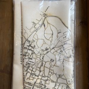
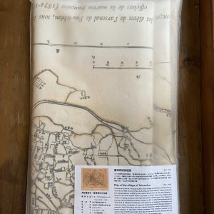
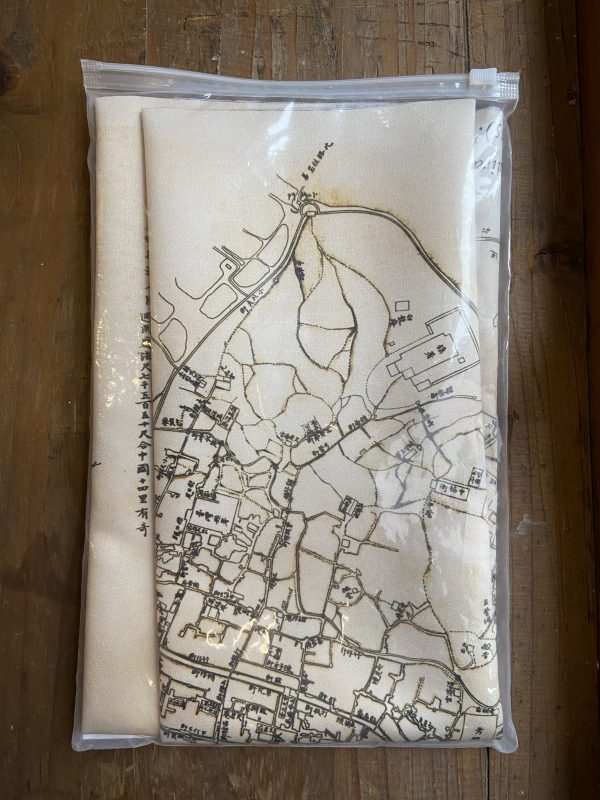
臺灣府城街道圖 地圖布
內容簡介
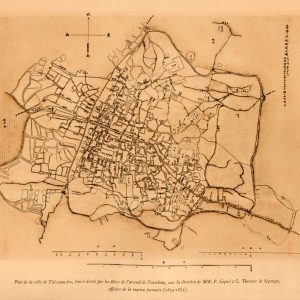
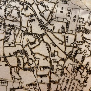
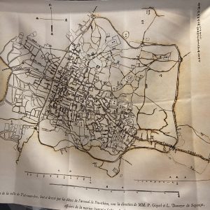
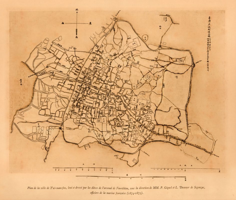
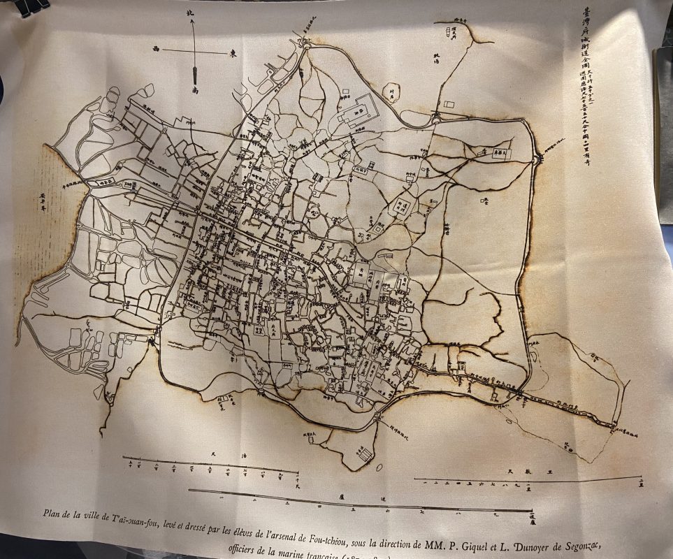
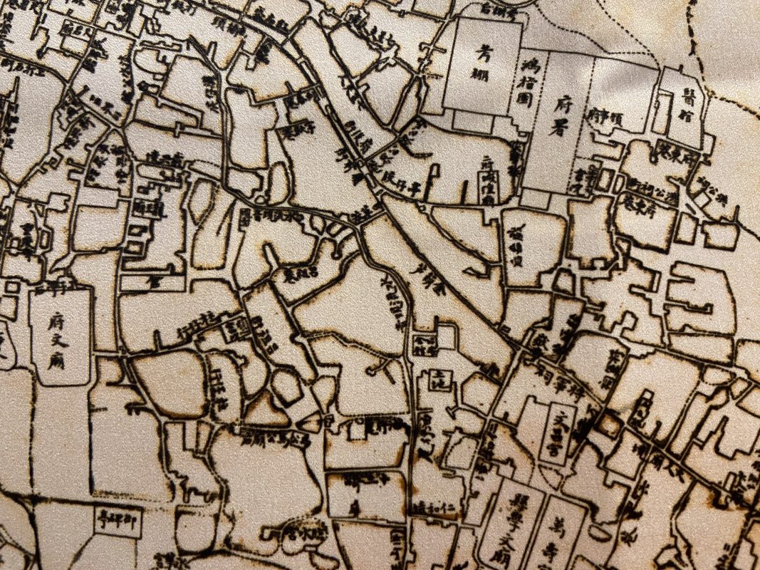
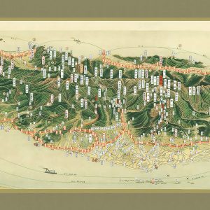
臺灣府城街道圖
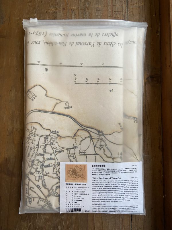
Plan de la ville de T’aï-ouan-fou (Plan of the village of Taiwanfou)
台湾府城街道図
年代:1875
Year:1875
尺寸:75 x 60CM
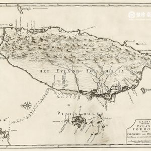
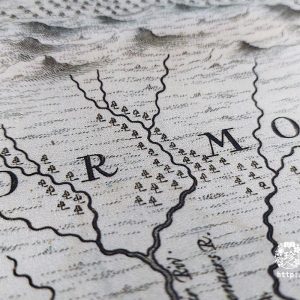
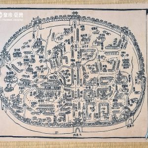
1875由福州船政局測繪之「臺灣府城街道全圖」(1:5000)及「臺灣府城並安平海口圖」(1:10000),為臺南已知最早以現代測繪技術製作的城市地圖,並且標上了街道地名,非常珍貴。此圖產生之背景,為牡丹社事件沈葆楨任欽差大臣,找了法國顧問協助辦理防務,除築億載金城外,也以現代技術繪製地圖。
The Plan de la ville de T’aï-ouan-fu (Plan of the Village of Taiwanfou) and the Plan de la ville de Tae-Wan-Fou et de Plaine de An-Ping (Formose) (Map of Taiwan Prefecture and Anping Seaport), crafted by the Hok-chiu Ship Bureau of the Qing Dynasty in 1875, are two of the earliest known city maps of Tainan. They were created using modern surveying techniques and featured detailed street names. The creation of this map was prompted by the Bó͘-tan-siā Incident of 1871, in which 54 Ryukyuan sailors were killed by indigenous Taiwanese. This event led to Japanese intervention and subsequent Qing recognition of Japanese sovereignty over the Ryukyu Islands. In response, Sím Pó-tsing, the then imperial inspector, sought assistance from French advisors to strengthen defense strategies. This initiative resulted in the construction of the Eternal Golden Fort (also known as Jī-khun-sin Fortress) and the employment of modern mapping techniques to produce these maps.
1875年に福州船政局が測量した「台湾府城街道全図」(1:5000)及び「台湾府城並安平海口図」(1:10000)で、台南で知られる最も古い現代測量技術による都市地図です。街道の地名も記載されており、非常に貴重です。この地図が作られた背景には、牡丹社事件で沈葆楨が欽差大臣としてフランスの顧問を招いて防務を処理し、億載金城を築くと共に現代技術を用いて地図を作成しました。
產地:臺灣
製造日期:2024-07
材質:100%聚酯纖維
尺寸:75 x 60 cm ± 3%
相關商品
文化小物
文化小物
文化小物